 plumi
Ecosystems: CAIE IGCSE Geography questions
CAIE IGCSE Geography past-paper questions on Ecosystems, June 2024, June and November 2025, March 2026, a 9–1 variant, and the 2020 and 2027 specimens, with mark schemes and examiner’s reports where available.
Paper
All papers
Exam
All years
Calculations
Loading the full question list…
- 1
- 2
- 3
- 4
- 5
- 6
- 7
- 8
- 9
- 10
- 11
All 11 questions on Ecosystems, as a list
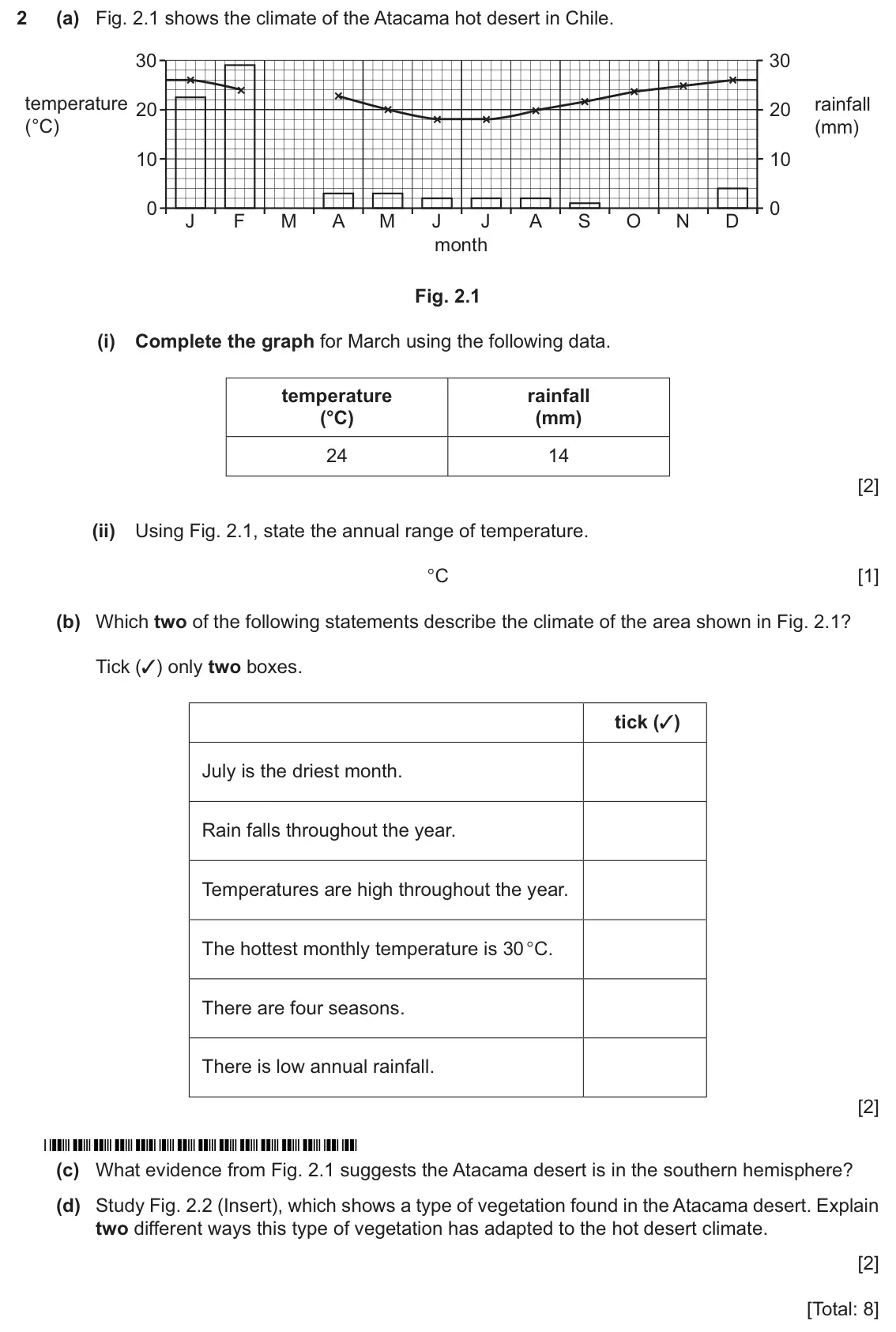
- November 2025, Paper 2 (21), Q2 (8 marks): (a) Fig. 2.1 shows the climate of the Atacama hot desert in Chile. 30 30 temperature rainfall 20 20 (°C) (mm) 10 10 0 0 J F M A M J J A S O N D month Fig. 2.1 (
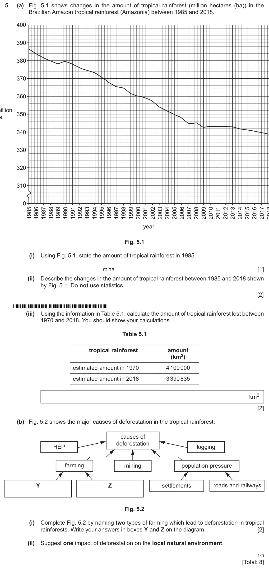
- November 2025, Paper 2 (22), Q5 (8 marks): (a) Fig. 5.1 shows changes in the amount of tropical rainforest (million hectares (ha)) in the Brazilian Amazon tropical rainforest (Amazonia) between 1985 and
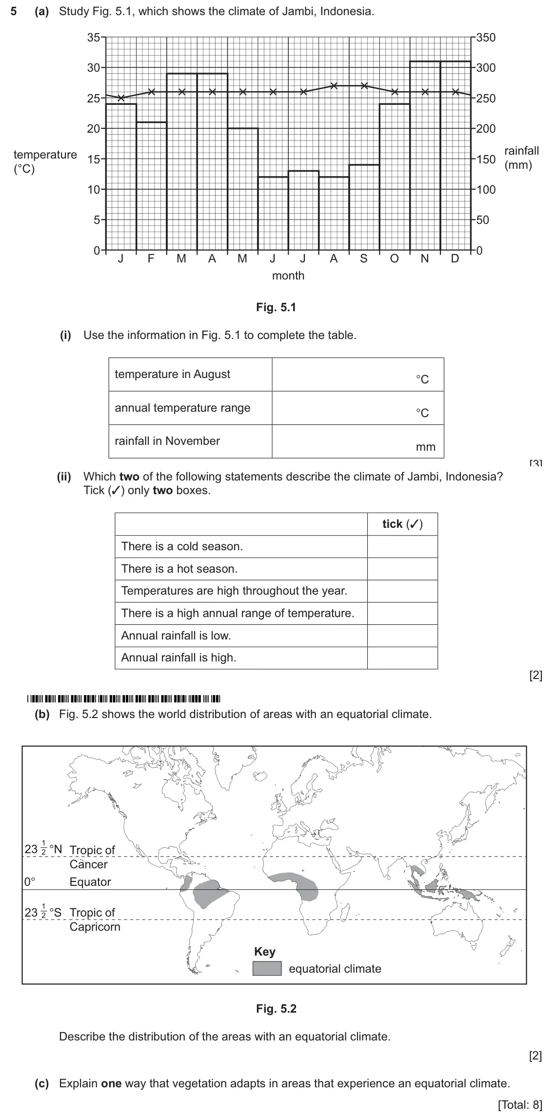
- November 2025, Paper 2 (23), Q5 (8 marks): (a) Study Fig. 5.1, which shows the climate of Jambi, Indonesia. 35 350 30 300 25 250 20 200 rainfall temperature 15 150 (mm) (°C) 10 100 5 50 0 0 J F M A M J J
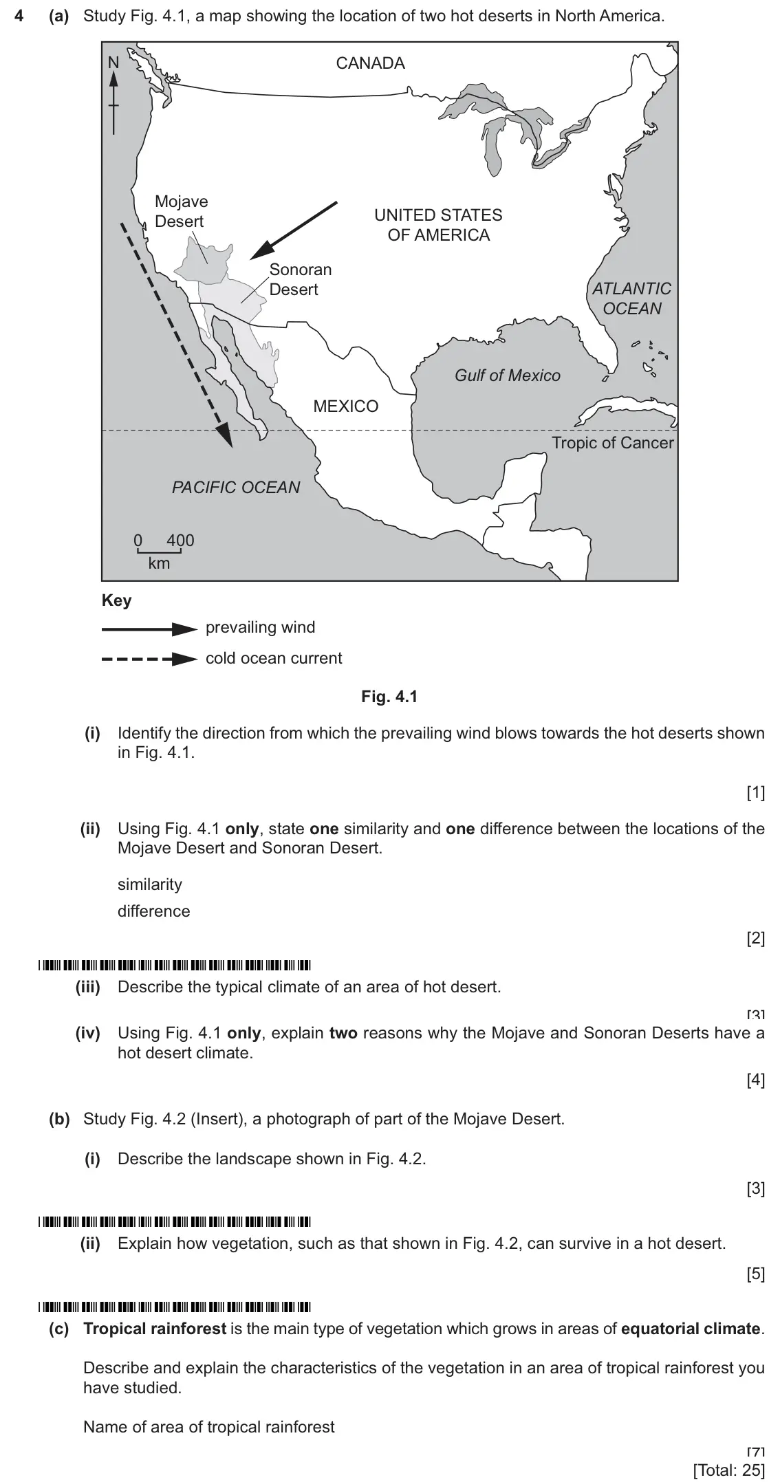
- June 2025, Paper 1 (13), Q4 (25 marks): (a) Study Fig. 4.1, a map showing the location of two hot deserts in North America. N CANADA Mojave UNITED STATES Desert OF AMERICA Sonoran Desert ATLANTIC OCEA
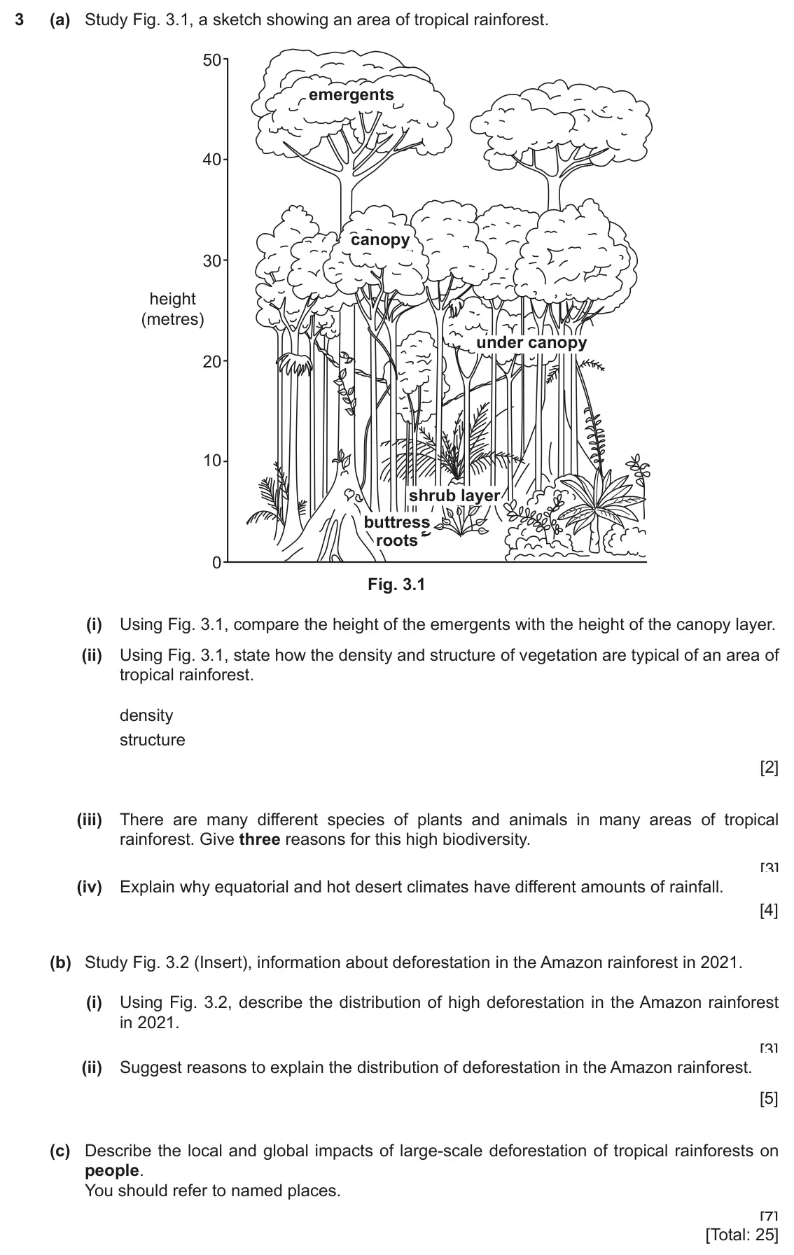
- June 2024, Paper 1, Q3 (25 marks): (a) Study Fig. 3.1, a sketch showing an area of tropical rainforest. 50 emergents 40 canopy 30 height (metres) under canopy 20 10 shrub layer buttress roots 0 F
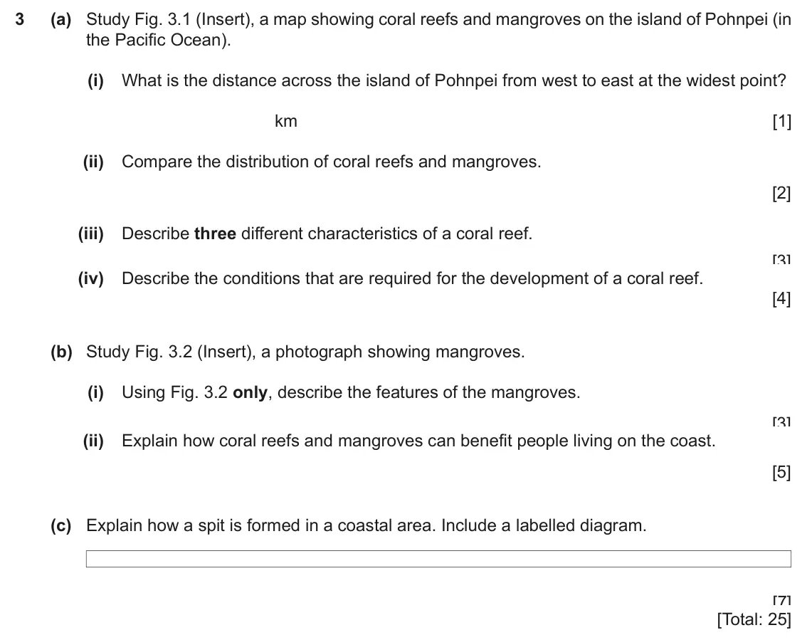
- June 2024 (9–1 variant), Paper 1, Q3 (25 marks): (a) Study Fig. 3.1 (Insert), a map showing coral reefs and mangroves on the island of Pohnpei (in the Pacific Ocean). (i) What is the distance across the island
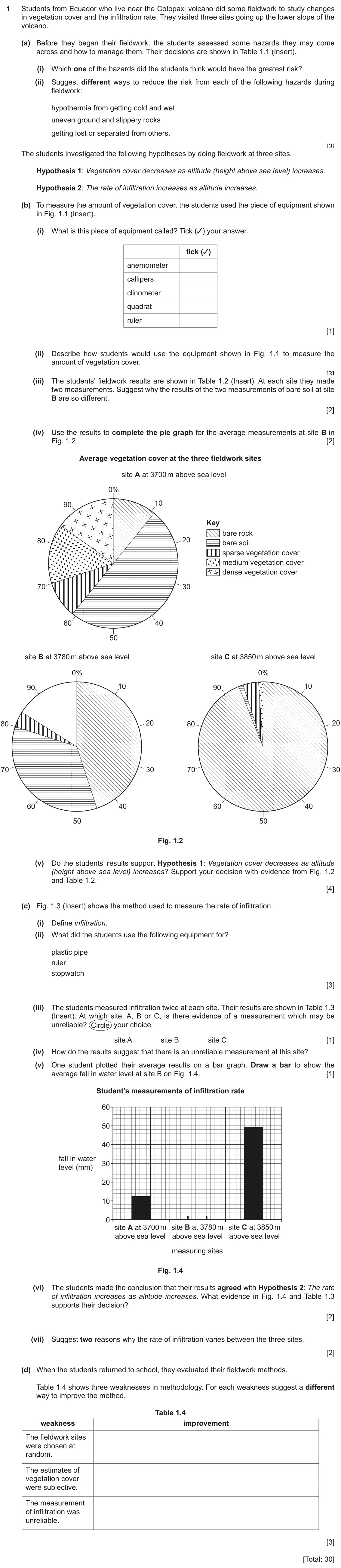
- June 2024 (9–1 variant), Paper 4, Q1 (30 marks): Students from Ecuador who live near the Cotopaxi volcano did some fieldwork to study changes in vegetation cover and the infiltration rate. They visited three s
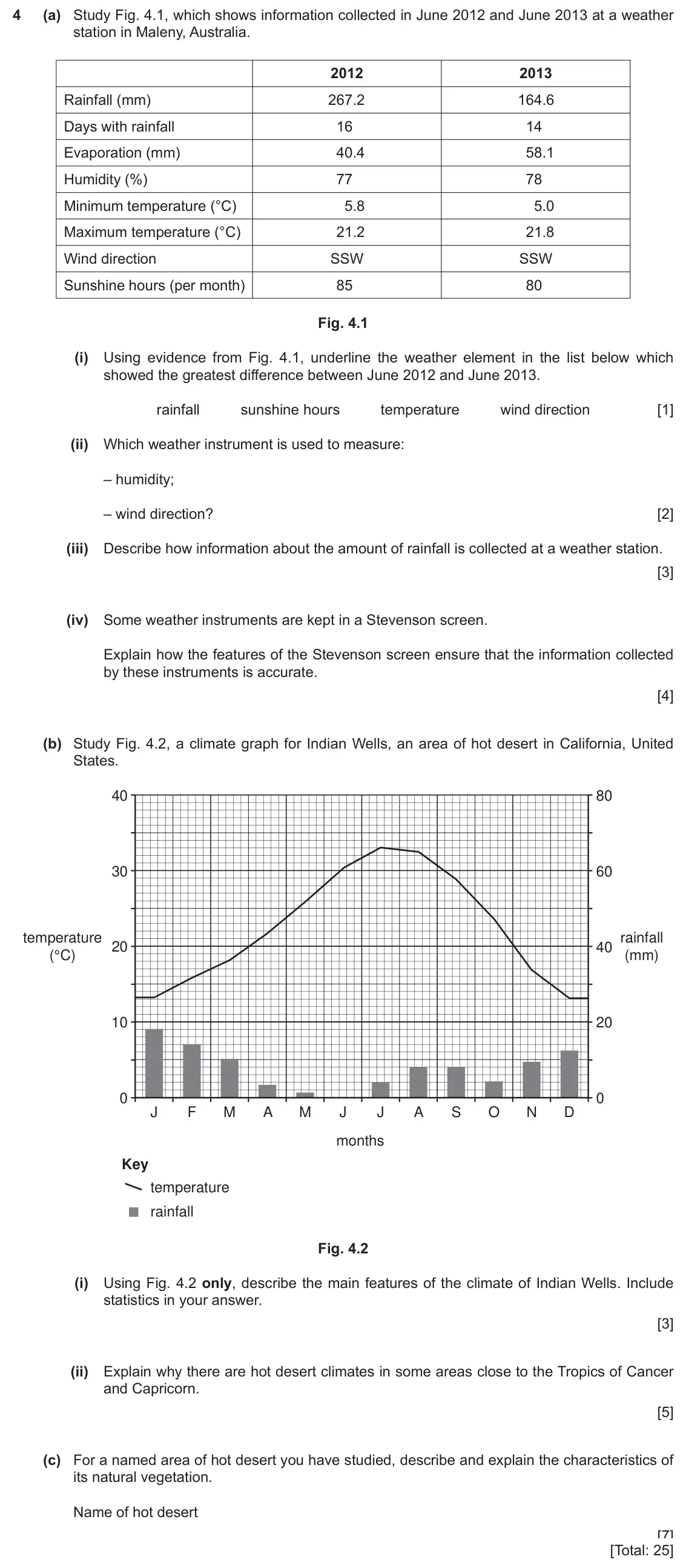
- 2020 specimen, Paper 1, Q4 (25 marks): (a) Study Fig. 4.1, which shows information collected in June 2012 and June 2013 at a weather station in Maleny, Australia. 2012 2013 Rainfall (mm) 267.2 164.6
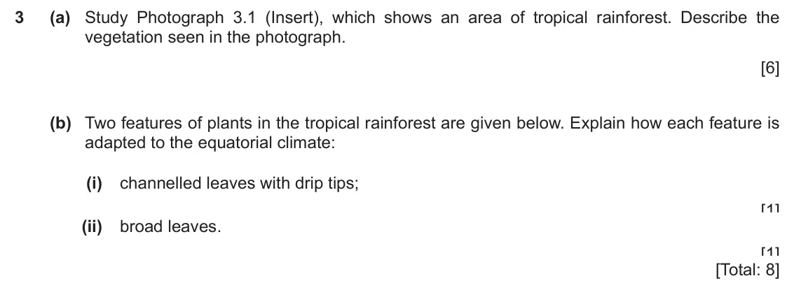
- 2020 specimen, Paper 2, Q3 (8 marks): (a) Study Photograph 3.1 (Insert), which shows an area of tropical rainforest. Describe the vegetation seen in the photograph. [6] (b) Two features of plants in
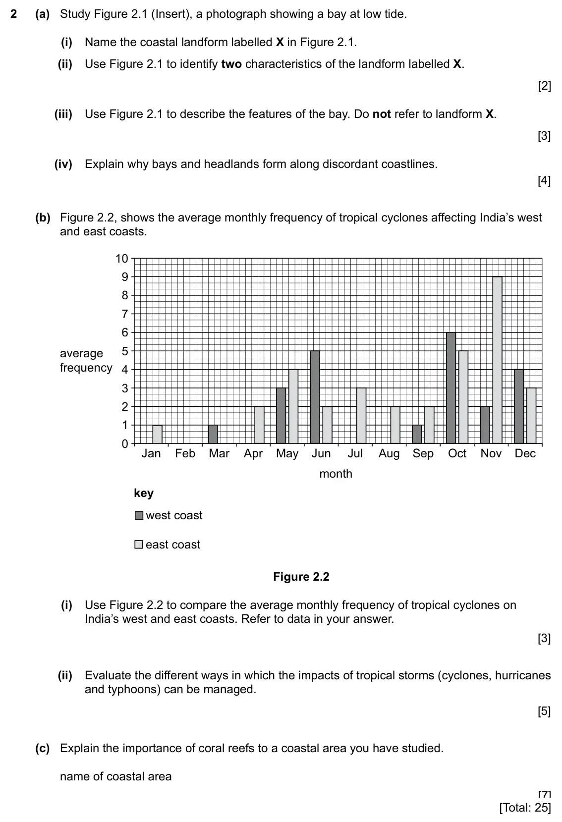
- 2027 specimen, Paper 1, Q2 (25 marks): (a) Study Figure 2.1 (Insert), a photograph showing a bay at low tide. (i) Name the coastal landform labelled X in Figure 2.1. [1] (ii) Use Figure 2.1 to identi
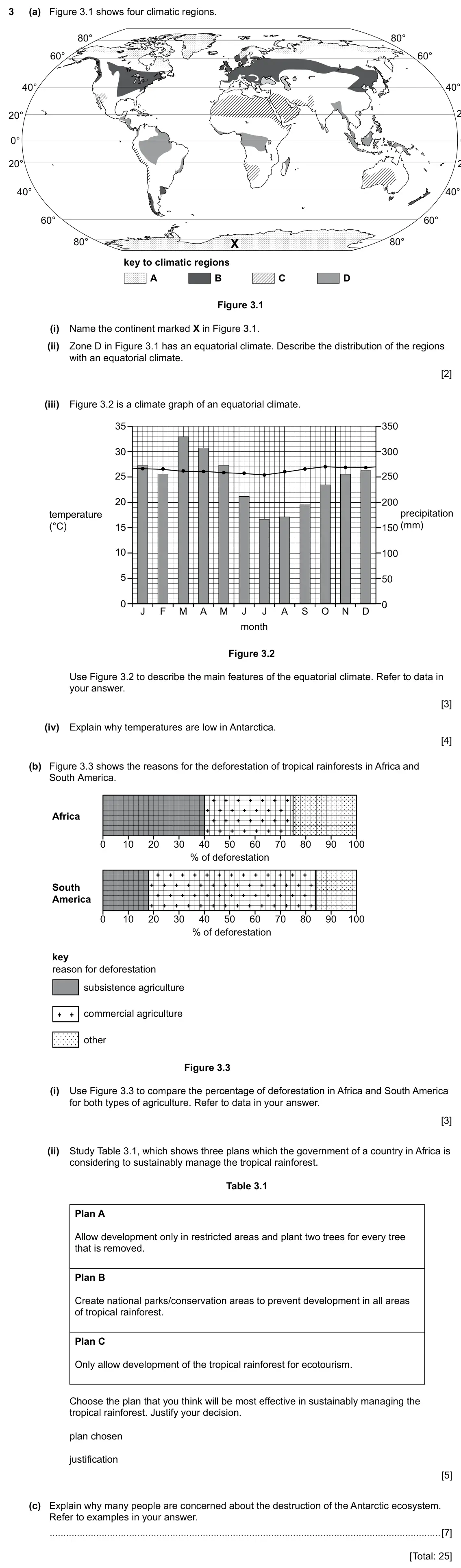
- 2027 specimen, Paper 1, Q3 (25 marks): (a) Figure 3.1 shows four climatic regions. 80° 80° 60° 60° 40° 40° 20° 0° 20° 40° 40° 60° 60° 80° X 80° key to climatic regions A B C D Figure 3.1 (i) Name the
Questions, mark schemes and examiner’s reports are © Cambridge University Press & Assessment, from their published past papers. Plumi isn’t affiliated with any exam board. Want whole papers? CAIE IGCSE Geography past papers.
The Plumi iPad app also offers exam-style questions with AI feedback on your handwritten working.