Skip to content
Android waitlistTry on iPad
Get started

CAIE IGCSE Geography questions by topic

Topics Pick as many as you like. Open one to choose its sub-topics.

By area

Paper
All papers
Exam
All years
Calculations

Loading the full question list…

122 questions

  1. Q2

    March 2026 · Paper 1 (12)

    25 marks
    Sources (insert) ↗
    The whole paper ↗
    1
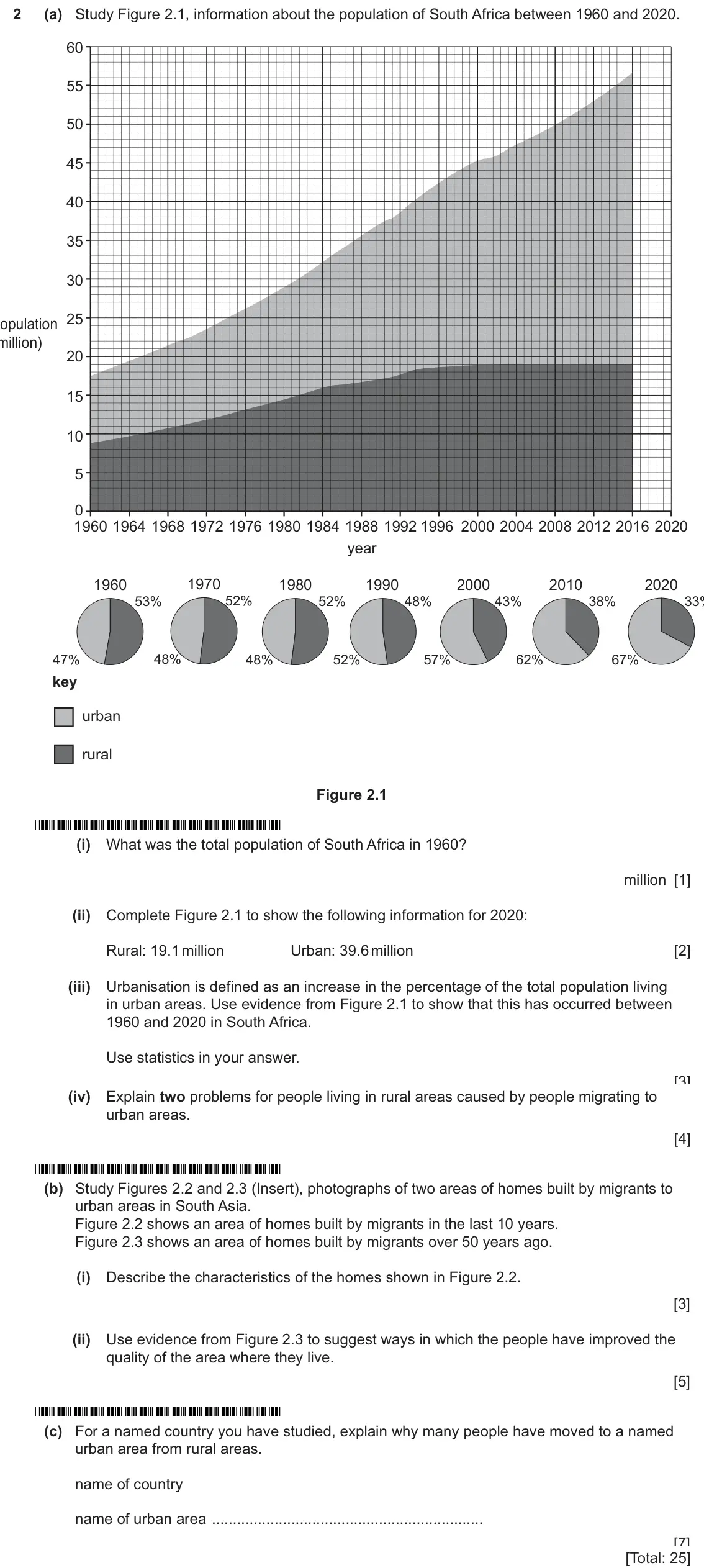
    Original question 2: (a) Study Figure 2.1, information about the population of South Africa between 1960 and 2020. 60 55 50 45 40 35 30 25 population (million) 20 15 10 5 0 1960 196

    Loading the question…

  2. Q3

    March 2026 · Paper 1 (12)

    25 marks
    Sources (insert) ↗
    The whole paper ↗
    2
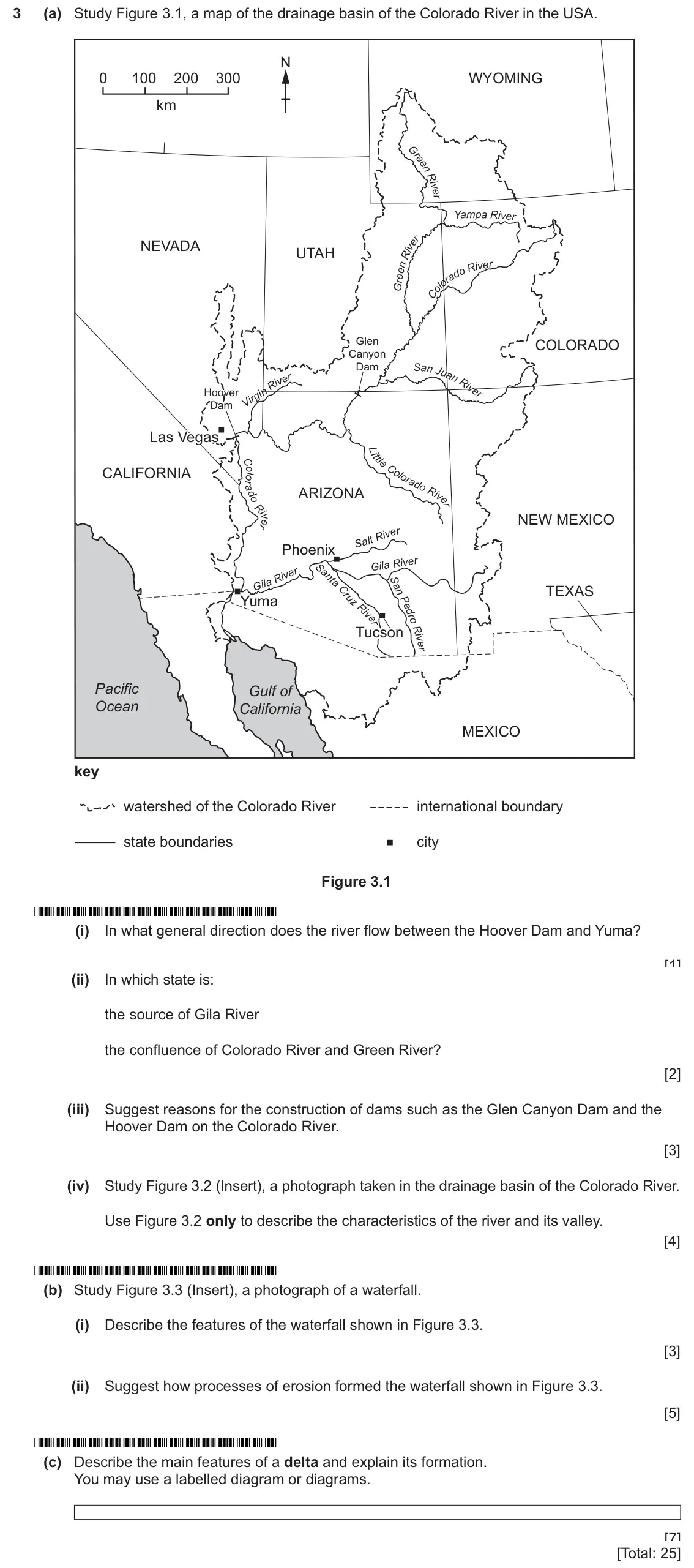
    Original question 3: (a) Study Figure 3.1, a map of the drainage basin of the Colorado River in the USA. N 0 100 200 300 WYOMING km Yam pa R ive r NEVADA UTAH R iv er Glen COLORADO

    Loading the question…

  3. Q4

    March 2026 · Paper 1 (12)

    25 marks
    Sources (insert) ↗
    The whole paper ↗
    3
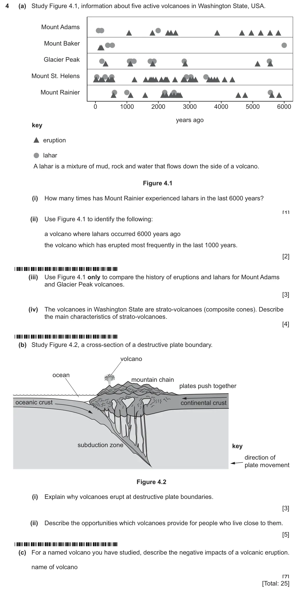
    Original question 4: (a) Study Figure 4.1, information about five active volcanoes in Washington State, USA. Mount Adams Mount Baker Glacier Peak Mount St. Helens Mount Rainier 0 10

    Loading the question…

  4. Q6

    March 2026 · Paper 1 (12)

    25 marks
    Sources (insert) ↗
    The whole paper ↗
    4
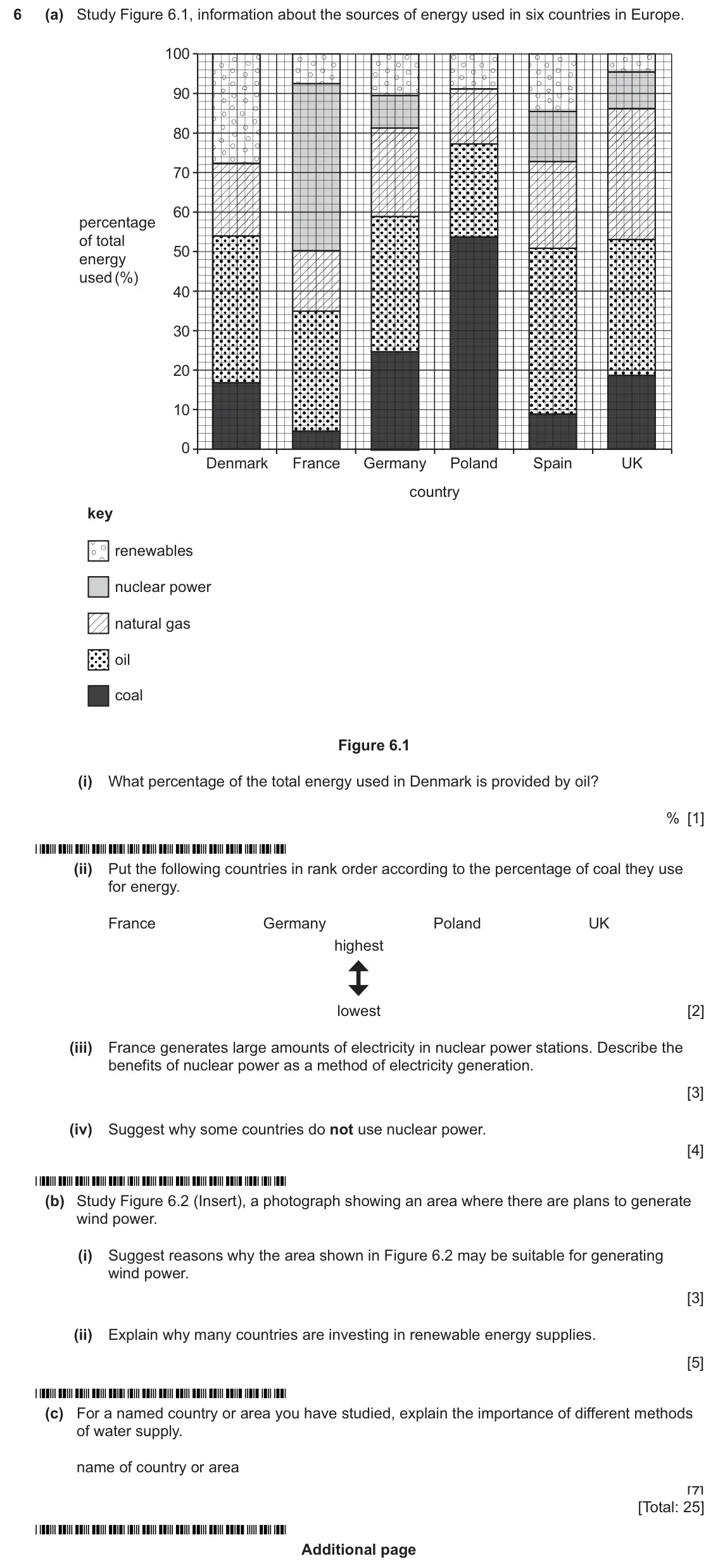
    Original question 6: (a) Study Figure 6.1, information about the sources of energy used in six countries in Europe. 100 90 80 70 60 percentage of total 50 energy used (%) 40 30 20 1

    Loading the question…

  5. Q1

    March 2026 · Paper 2 (22)

    20 marks
    Sources (insert) ↗
    The whole paper ↗
    5
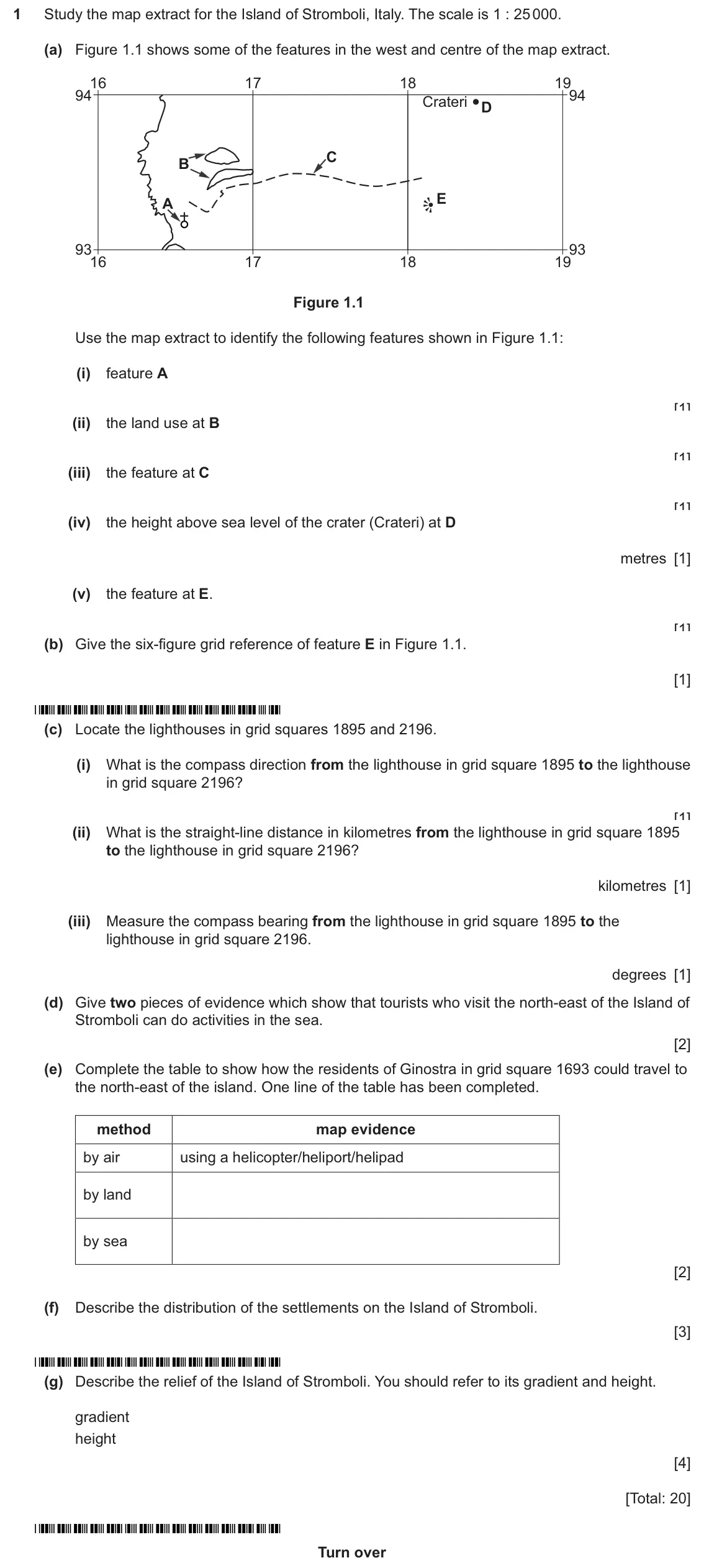
    Original question 1: Study the map extract for the Island of Stromboli, Italy. The scale is 1 : 25 000. (a) Figure 1.1 shows some of the features in the west and centre of the map e

    Loading the question…

  6. Q2

    March 2026 · Paper 2 (22)

    8 marks
    Sources (insert) ↗
    The whole paper ↗
    6
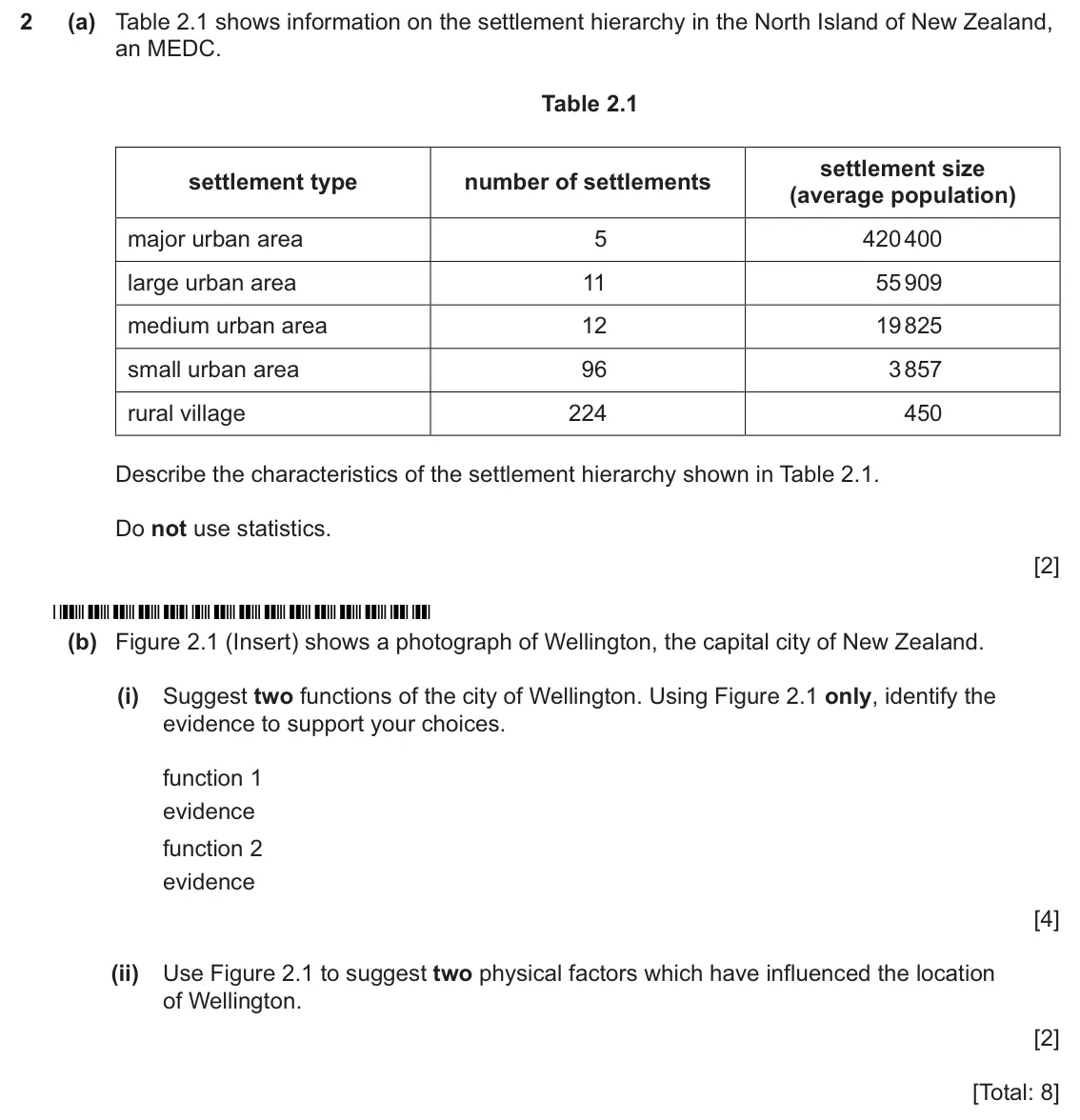
    Original question 2: (a) Table 2.1 shows information on the settlement hierarchy in the North Island of New Zealand, an MEDC. Table 2.1 settlement size settlement type number of set

    Loading the question…

  7. Q3

    March 2026 · Paper 2 (22)

    8 marks
    Sources (insert) ↗
    The whole paper ↗
    7
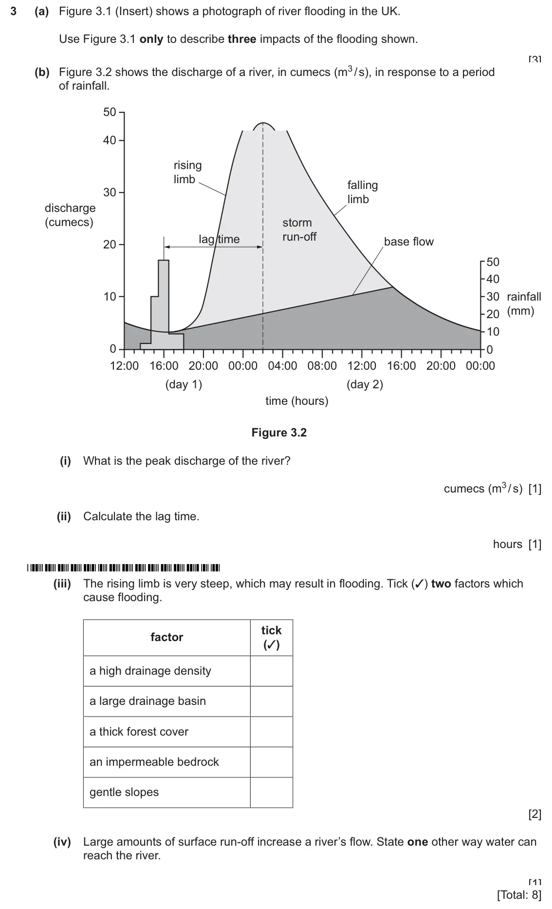
    Original question 3: (a) Figure 3.1 (Insert) shows a photograph of river flooding in the UK. Use Figure 3.1 only to describe three impacts of the flooding shown. 1 2 3 [3] (b) Figur

    Loading the question…

  8. Q4

    March 2026 · Paper 2 (22)

    8 marks
    Sources (insert) ↗
    The whole paper ↗
    8
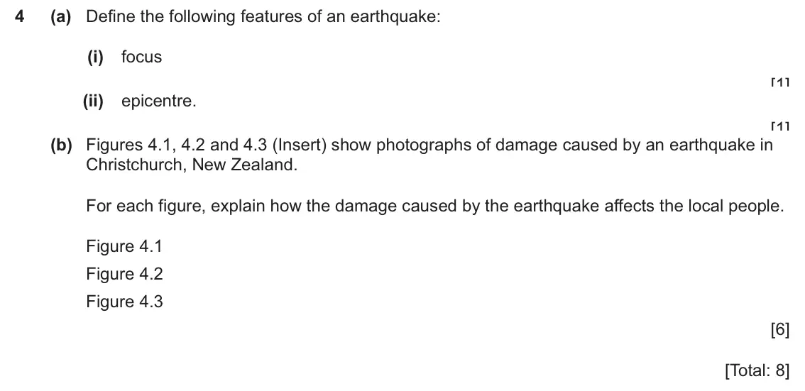
    Original question 4: (a) Define the following features of an earthquake: (i) focus [1] (ii) epicentre. [1] (b) Figures 4.1, 4.2 and 4.3 (Insert) show photographs of damage caused by

    Loading the question…

  9. Q5

    March 2026 · Paper 2 (22)

    8 marks
    Sources (insert) ↗
    The whole paper ↗
    9
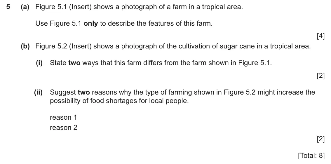
    Original question 5: (a) Figure 5.1 (Insert) shows a photograph of a farm in a tropical area. Use Figure 5.1 only to describe the features of this farm. [4] (b) Figure 5.2 (Insert)

    Loading the question…

  10. Q6

    March 2026 · Paper 2 (22)

    8 marks
    Sources (insert) ↗
    The whole paper ↗
    10
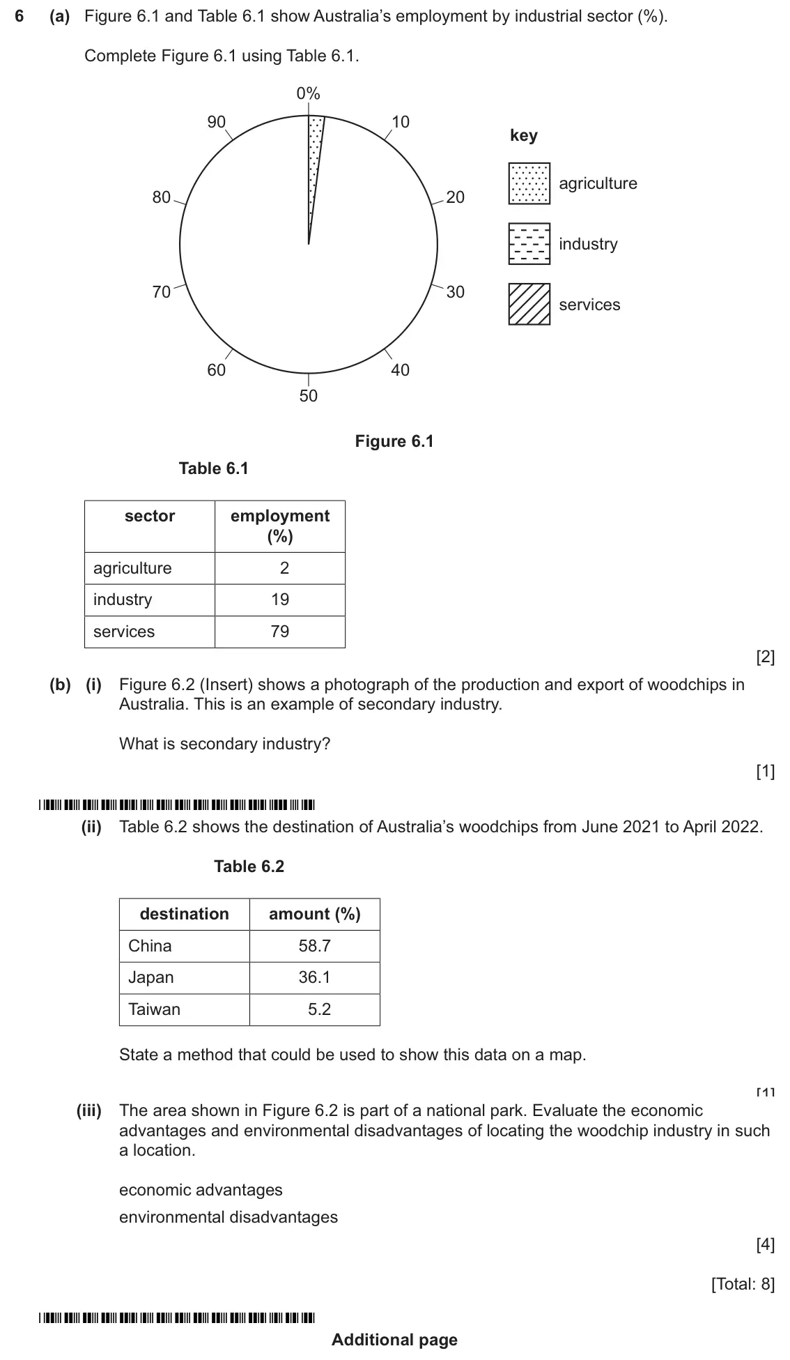
    Original question 6: (a) Figure 6.1 and Table 6.1 show Australia’s employment by industrial sector (%). Complete Figure 6.1 using Table 6.1. 0% 90 10 key agriculture 80 20 industry

    Loading the question…

  11. Q1

    March 2026 · Paper 4 (42)

    30 marks
    Sources (insert) ↗
    The whole paper ↗
    11
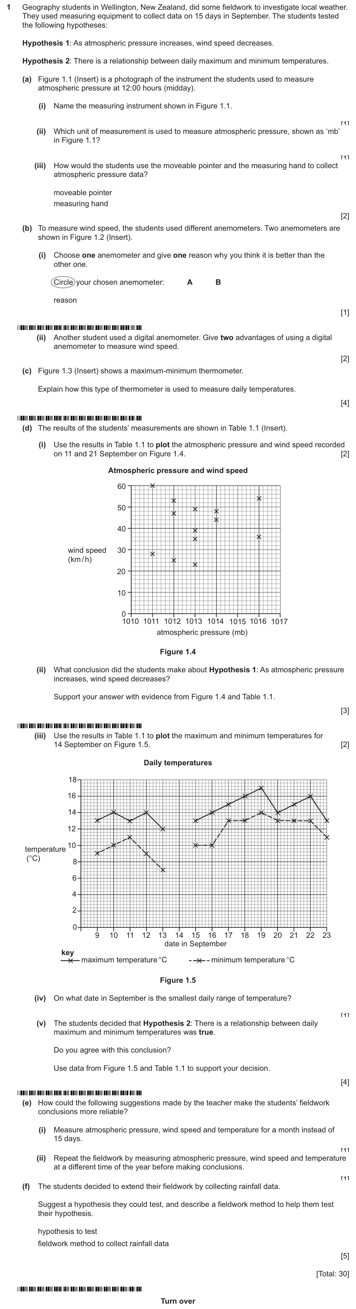
    Original question 1: Geography students in Wellington, New Zealand, did some fieldwork to investigate local weather. They used measuring equipment to collect data on 15 days in Sept

    Loading the question…

  12. Q2

    March 2026 · Paper 4 (42)

    30 marks
    Sources (insert) ↗
    The whole paper ↗
    12
    Original question 2: A new supermarket was opened in the CBD of a town in the UK. Students from a local school decided to investigate the impact of this new supermarket in the town

    Loading the question…

  13. Q1

    November 2025 · Paper 1 (11)

    25 marks
    Sources (insert) ↗
    The whole paper ↗
    13
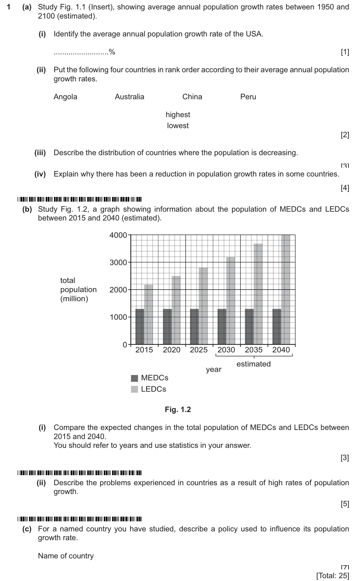
    Original question 1: (a) Study Fig. 1.1 (Insert), showing average annual population growth rates between 1950 and 2100 (estimated). (i) Identify the average annual population growth

    Loading the question…

  14. Q2

    November 2025 · Paper 1 (11)

    25 marks
    Sources (insert) ↗
    The whole paper ↗
    14
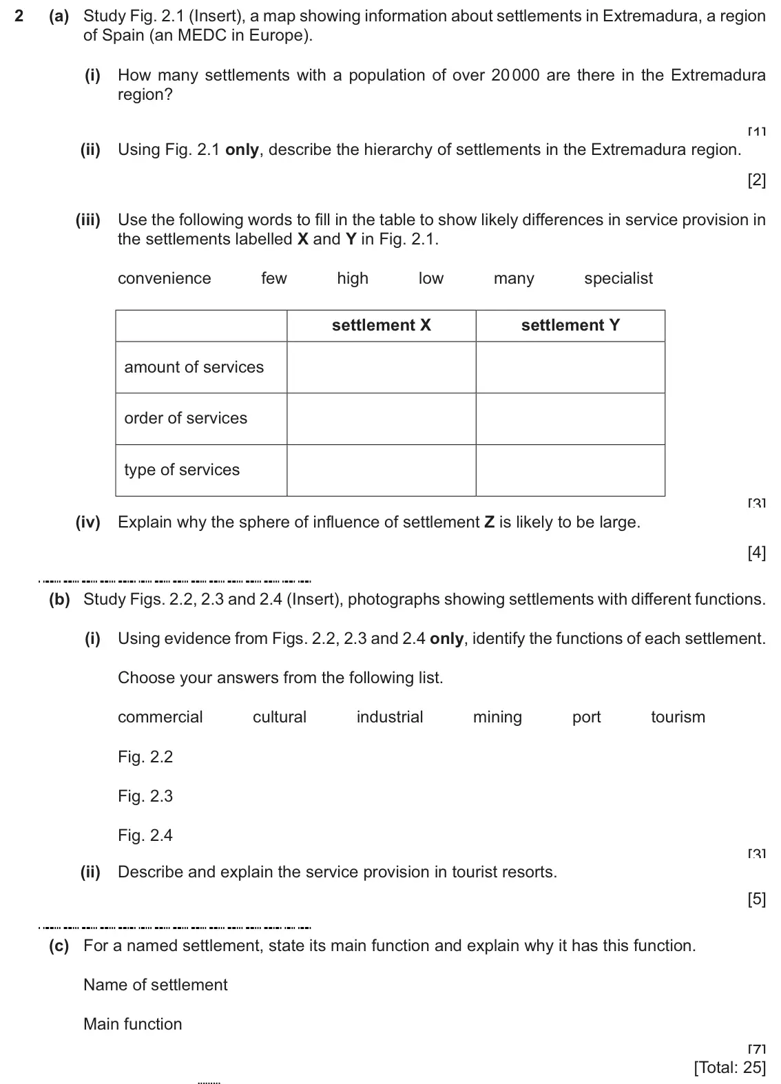
    Original question 2: (a) Study Fig. 2.1 (Insert), a map showing information about settlements in Extremadura, a region of Spain (an MEDC in Europe). (i) How many settlements with a

    Loading the question…

  15. Q3

    November 2025 · Paper 1 (11)

    25 marks
    Sources (insert) ↗
    The whole paper ↗
    15
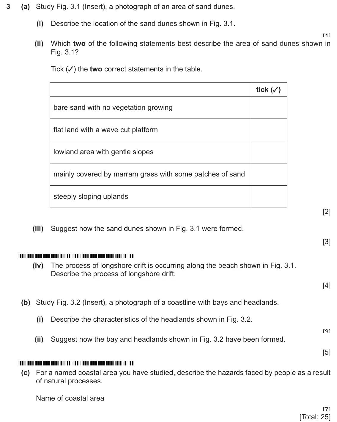
    Original question 3: (a) Study Fig. 3.1 (Insert), a photograph of an area of sand dunes. (i) Describe the location of the sand dunes shown in Fig. 3.1. [1] (ii) Which two of the fol

    Loading the question…

  16. Q4

    November 2025 · Paper 1 (11)

    25 marks
    Sources (insert) ↗
    The whole paper ↗
    16
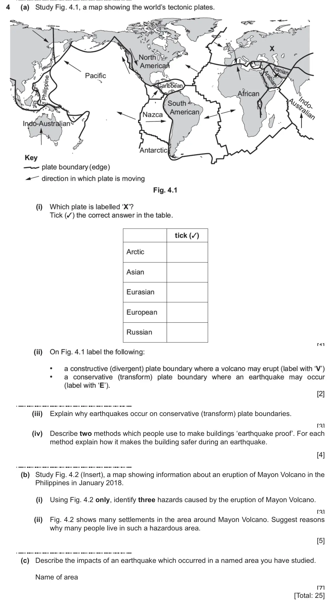
    Original question 4: (a) Study Fig. 4.1, a map showing the world's tectonic plates. North F American ranial Arabians Pacific Philippine aribbean African Australian ngo. South • Amer

    Loading the question…

  17. Q5

    November 2025 · Paper 1 (11)

    25 marks
    Sources (insert) ↗
    The whole paper ↗
    17
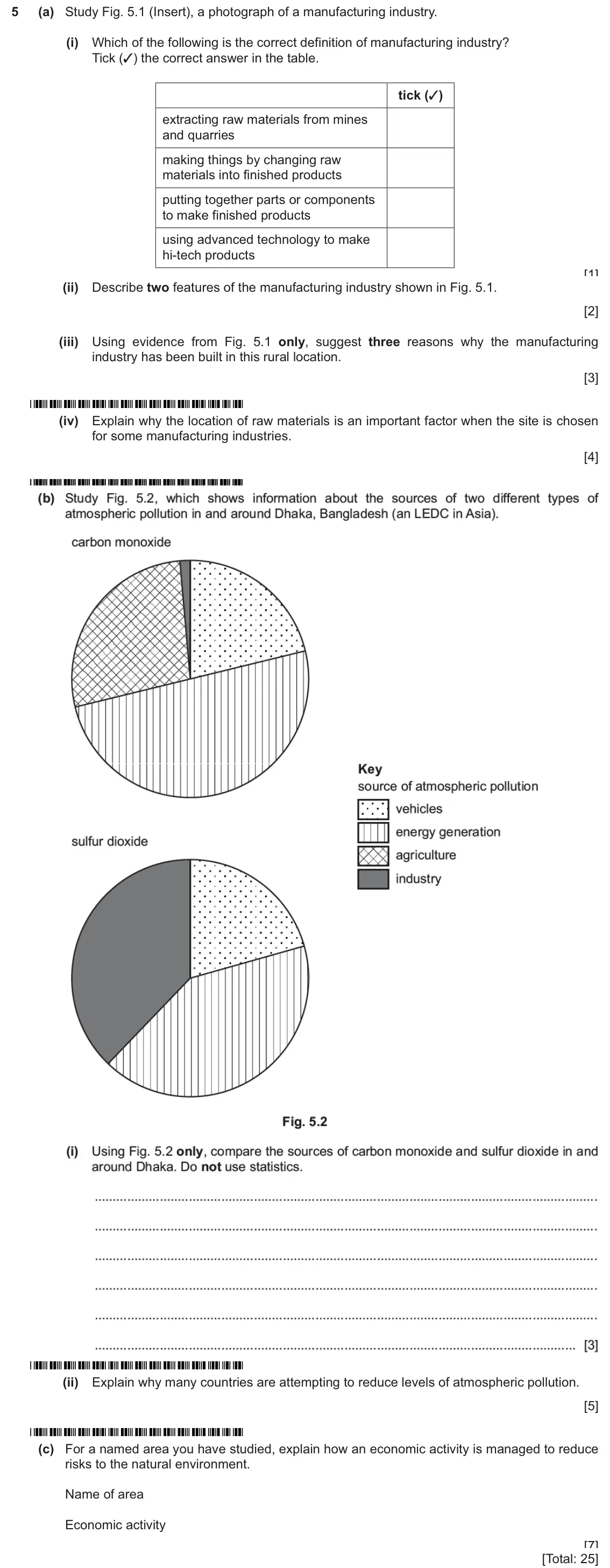
    Original question 5: (a) Study Fig. 5.1 (Insert), a photograph of a manufacturing industry. (i) Which of the following is the correct definition of manufacturing industry? Tick (3)

    Loading the question…

  18. Q2

    November 2025 · Paper 1 (12)

    25 marks
    Sources (insert) ↗
    The whole paper ↗
    18
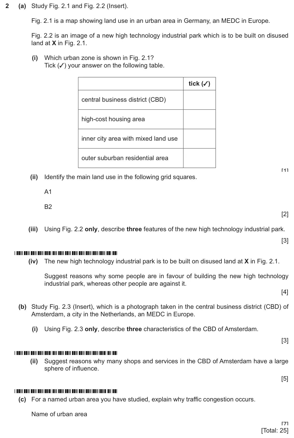
    Original question 2: (a) Study Fig. 2.1 and Fig. 2.2 (Insert). Fig. 2.1 is a map showing land use in an urban area in Germany, an MEDC in Europe. Fig. 2.2 is an image of a new high

    Loading the question…

  19. Q4

    November 2025 · Paper 1 (12)

    25 marks
    Sources (insert) ↗
    The whole paper ↗
    19
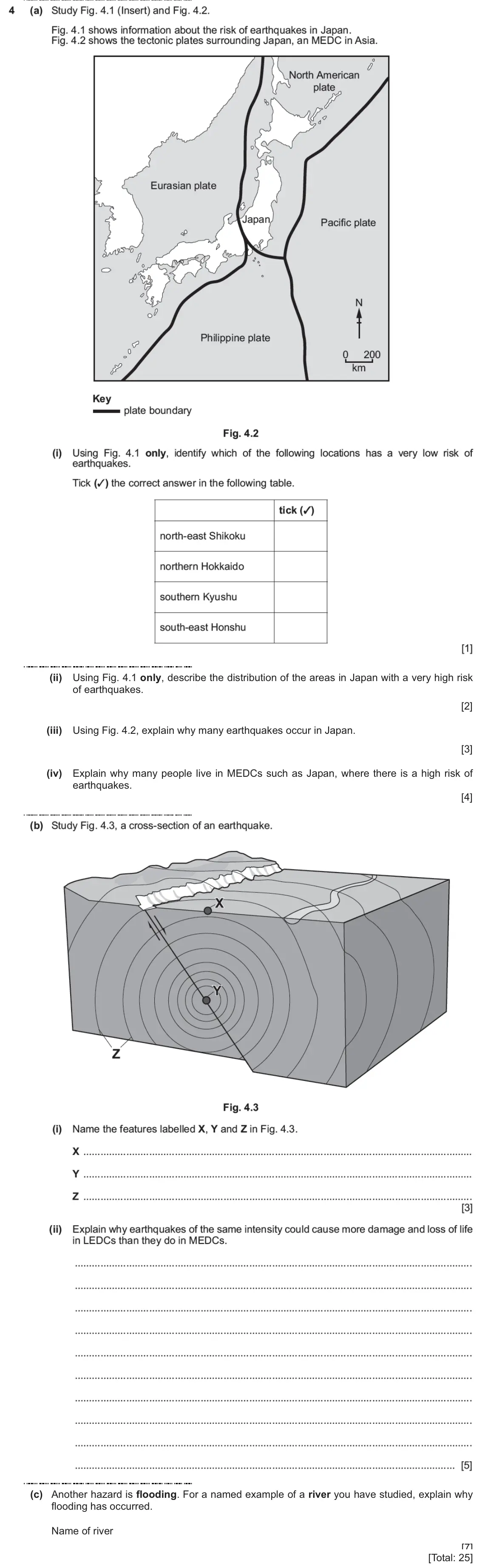
    Original question 4: (a) Study Fig. 4.1 (Insert) and Fig. 4.2. Fig. 4.1 shows information about the risk of earthquakes in Japan. Fig. 4.2 shows the tectonic plates surrounding Japa

    Loading the question…

  20. Q5

    November 2025 · Paper 1 (12)

    25 marks
    Sources (insert) ↗
    The whole paper ↗
    20
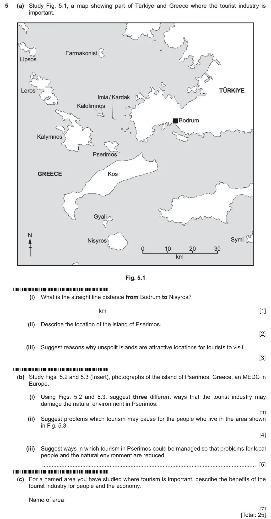
    Original question 5: (a) Study Fig. 5.1, a map showing part of Türkiye and Greece where the tourist industry is important. te n5 Farmakonisi 3 Lipsos TÜRKIYE Leros Imia/Kardak Kalol

    Loading the question…

Questions, mark schemes and examiner’s reports are © Cambridge University Press & Assessment, from their published past papers. Plumi isn’t affiliated with any exam board. Want whole papers? CAIE IGCSE Geography past papers.

The Plumi iPad app also offers exam-style questions with AI feedback on your handwritten working.